Record # 3431 -- Image Metadata
Historical photograph record:
| Record ID | 3431 |
| Photographer | Cooper |
| Digital image number | Cooper_672 |
| Date of photograph | no date recorded |
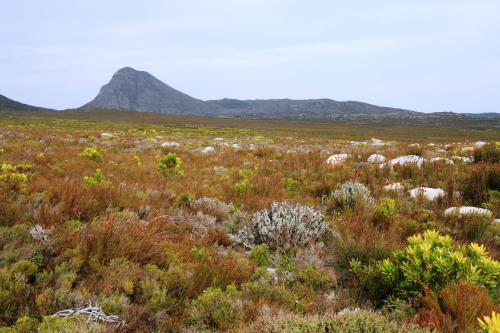
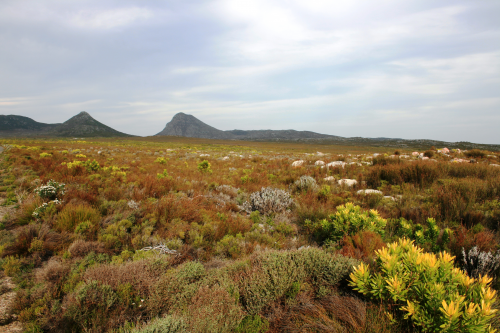
| Original caption | Cape Point after fire |
| Location description | |
| QDS | 3418AD |
| Coordinates | 34.269 18.445 |
| Attribution | rephotosa.adu.org.za - UCT |
Repeat photograph record:
| Repeat id | 182 |
| Record id | 3431 |
| Digital image number | Cooper_672 |
| Photographer | Watermeyer, John; Mark Kraus |
| Day | 13 |
| Month | 1 |
| Year | 2016 |
| Time period | 14:50 |
| Height camera (cm) | 155 |
| Height camera quality | ESTIMATED |
| Location description | On the Olifantsbos Road, 1.1 km from the main road to Cape Point |
| Location cairn | YES |
| Landscape changes | Good coverage of the ground. |
| Weather conditions | Hazy summer day. |
| Additional notes | |
| Latitude | 34.269 |
| Longitude | 18.445 |
| Coords uncertainty description | GPS: precision unknown |
| Coords source | GPS |
| Attribution | Watermeyer, John; rephotosa.adu.org.za; PCU; UCT |
| PCU repeat | NO |
| Published | YES |
| Date uploaded | 2018-04-10 12:51:48 |
| Date last updated | 2018-04-10 12:51:48 |
Main repeat photo:

Wide-angle view:

 The Plant Conservation Unit (PCU) is an African-centred research and postgraduate training unit. It aims to improve the ecological understanding and conservation status of Africa's biomes, and has a particular emphasis on the succulent karoo and fynbos biomes of South Africa.
 The FitzPatrick Institute of African Ornithology aims to "To promote and undertake scientific studies involving birds, and contribute to the practice affecting the maintenance of biological diversity and the sustained use of biological resources."
 The University of Cape Town is known for its academic excellence and pioneering scholarship. Through a culture of teaching and learning, UCT strives to turn out graduates who are engaged citizens, able and willing to apply their expertise across the African continent.
